
Table of Contents
The measurement and path profile tool can be used to calculate distance and a path profile chart between multiple points on the map.
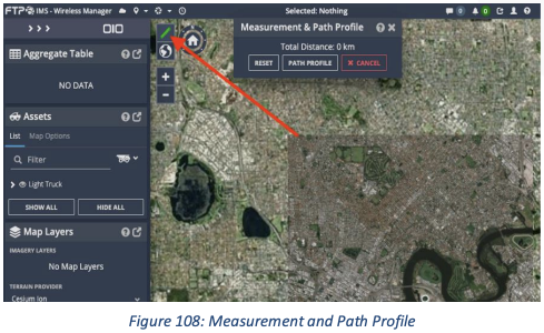
Measurement Tool
To calculate distances between multiple points, left click twice anywhere on the map. You will see a white line appear that indicates the distance between the two selected points. You can change the location of the point by clicking and dragging it to your desired location.
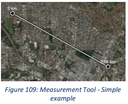
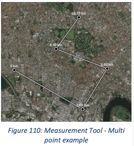
You can keep on clicking on the map to continue calculating cumulative distance. If you have made a mistake and need to delete a point you can simply right click it. To add an extra point in the middle of an existing line, click anywhere on the line and drag it.
To clear a line either click ‘reset’ to clear the line or ‘cancel’ to clear and close the line and popup.
Path Profile Tool
The Path Profile tool is used to generate a path profile chart from points selected on a map. This can be used to view heights and direct line of sight between two points. You can update the frequency and heights of the points by changing the values on the right-hand side.
More than two points can be used in the path profile tool. Be aware however that the calculation is computationally intensive, and you may experience a sluggishness (depending on your computer’s hardware).
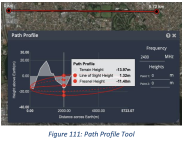
To clear a path profile either click ‘reset’ to clear the path profile or ‘cancel’ to clear and close the path profile line and popup.

Underground Sites
Note that the Measurement Tool can be used to calculate distances in underground tunnels however Path Profiling is not available when viewing an underground site.