
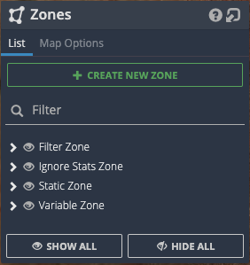
There are four types of Zones available in IMS. As you add Zones, they will appear in their respective categories in Zones > List
Ignore Stats – these zones automatically ignore the network data / stats that are collected inside them. This could be useful for areas of the mine that have poor IP connectivity and it is expected, say for example, a new area that doesn’t have comms infrastructure set up yet or an area that has had a hardware failure, like an AP on a trailer or a trailer / tower has lost power.
Ignore Stats Zones will also stop Assets inside them from being the cause of an Alert. It would be good to setup ignored zones around park ups and workshops.
Static – these zones are a zone that does not have a history, you can use them to define an area that you would like to keep more of an eye on, or to point out something to users of the IMS application. You can edit the shape of the zone any time you like, however, it will not remember its shape history. If you change the shape of the zone and you go back in time, then the shape will only reflect its most current shape.
Variable – This zone is exactly the same as a static zone except it does remember its shape history, so when you go back in time you will see the shape of the zone change in accordance with when it was actually updated. This type of zone is used to track the shape of a pit or a dump area over time.
Filter – This zone works with Estimated Movement By Zone stats that you can see in the Stat Browser. Use this zone type to geofence your area of interest. From that time onwards, Estimated Movement By Zone stats will be generated.
Labels in Map Options allow the user to toggle zone names off / on.
Underground Zones
Zones can also be created for underground layers as in the below example. Whilst creating the zone certain functionality will be disabled - such as switching underground layers - until zone creation is completed or canceled.

A zone is associated with an underground layer so a zone will only be visible if its associated layer is also visible. Underground zones are also 3D - unlike surface zones which are 2D - which means they have a height. The height of the zone will match the height of the layer it is created on. So if a layer ranges from -100m to -200m then the zone will also be 100m tall.
