
Configuration of Imagery Layers and Terrain Providers
Imagery layers and Terrain providers can be added, removed, and changed from the Administration tab.
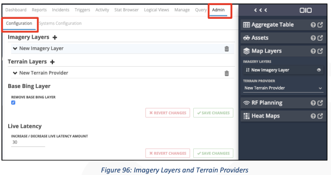
Modifying Imagery Layers
The following imagery providers are supported in IMS.
- Tile Map Service
- ArcGis
- OpenStreetMap
- Web Map Tile Service
- Cesium Ion Imagery
- Mapbox
- Webmap Service
Related Articles
4.1 Modifying Imagery Layers 4.2 Modifying Terrain Layers 4.3 Adding or modifying terrain providers